
Mapspace
Case study
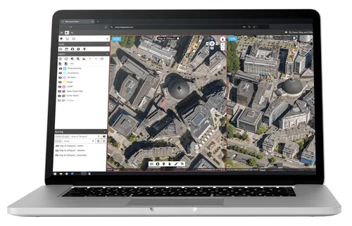
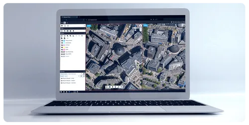
Mapspace: Geospatial web portal made for professionals who want to take data driven decisions
Mapspace Case Study
Who’s our partner?
Field Group
By combining software, sensors, and autonomous technologies, we put data to work to boost efficiency and reliability within the infrastructure, construction, environment, and public sectors.
source: www.field.group
We believe that the success of any project is based not only on task completion but, above all, on building relationships founded on trust, mutual understanding, and clear communication.
From the very beginning, we establish a routine of regular and transparent communication, set clear expectations, and promptly respond to changes in scope or emerging issues. This proactive approach ensures that the project stays on track and no time is wasted.

The client needed a fresh approach and, in reality, a completely new version of their MapSpace application.
We joined the project, which was burdened by significant technical debt, and had to straighten things out. Our goal was to help modernize the system to meet growing customer expectations while ensuring it would be scalable in a rapidly expanding market.
What is our proposition?
We always propose a thorough analysis and rethinking of which software components are essential and need to be scalable. Additionally, we regularly recommend necessary technology updates, introducing a more structured, agile approach to ensure process efficiency.
As part of our process, we implement and maintain bi-weekly sprint planning and iterations, followed by retrospectives and demo sessions, ensuring continuous progress and improvement of the project.
We don't limit ourselves to proposing just software development – if the client requires it, we also offer consulting services, helping to make strategic technological decisions.

The tech stack
Java is an object-oriented programming language currently developed by Oracle. It is a statically typed language, which means that variables must have specified data types at the compilation stage, increasing security and allowing for earlier detection of errors in the code.
One of Java's key advantages is its portability, as programs written in this language are compiled into bytecode, which can be run on any platform that has a Java Virtual Machine (JVM). This makes Java widely used across various domains, from web applications to mobile apps and embedded systems.
Java plays a crucial role in large projects, especially where scalability, performance, and stability are essential. With its rich ecosystem of libraries and tools, Java remains one of the most commonly chosen programming languages in enterprises, particularly for business applications and backend systems development.
- Java serves as the foundation for core backend services, ensuring high performance, scalability, and security in processing large datasets.
- OpenLayers enables the creation of dynamic, interactive web maps, allowing for efficient visualization and interaction with complex geospatial data.
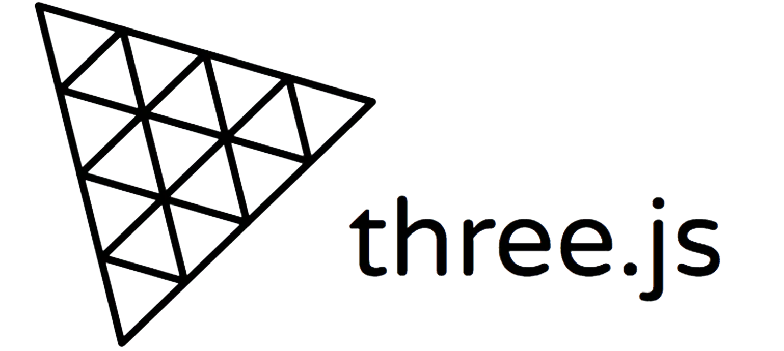
- Three.js facilitates advanced 3D visualizations, offering smooth rendering of detailed geospatial models and real-time interaction within the browser.
- GDAL handles the processing and manipulation of large geospatial datasets, automating tasks like data transformation, rasterization, and conversion to enhance workflow efficiency.
- Level of Detail tiling techniques are applied to optimize the rendering of large maps, progressively loading higher-resolution data as users zoom in, significantly boosting performance.
- Cesium provides real-time 3D geospatial visualization, accurately representing terrain, buildings, and other features on a global scale.


We applied a range of advanced technologies to meet complex challenges efficiently. Java powers backend with performance and scalability, while OpenLayers and Three.js enable interactive 2D and 3D geospatial visualizations.
GDAL automates geospatial data processing, and Level of Detail (LOD) tiling ensures optimized map rendering. Cesium brings real-time 3D visualization at a global scale. With the team's expertise, we quickly adapt and deliver robust solutions using these tools.
ISO 27001 Certified Partner
We are excited to announce a key milestone in our commitment to high data security and information management standards: achieving the globally recognized ISO 27001 certification for our information security management system (ISMS).

Working with Codeflyers has been a game-changer for us! Their innovative approach and unparalleled technical expertise have propelled our project to new heights. We're thrilled with the progress and their proactive attitude.
Christoffer Apneseth
CTO at Field
Code Flyers Sp. z o.o.
NIP 7252322818
Piotrkowska 21/17
90-406 Łódź, Poland
Email: hi@codeflyers.com

Follow us

We believe that business and IT needs must be solved in a new and more future-oriented way. Needs must be realized faster and the solutions must create more value to maintain competitive advantage in a digital world that moves at a fast pace.